 Warsaw
- Part 1
Warsaw
- Part 1Social Stratification
in Eastern Europe After 1989:
General Population Survey
APPENDIX F
Country-specific Geographical Codes - Poland - Warsaw sample
Part One Part Two Part Three Part Four
Data were collected for a special sample of the Warsaw population in
September-November 1994, using a questionnaire identical to the questionnaire
used for the national survey with the exception of a few questions added
to the end of the questionnaire for methodological studies being undertaken
by the Polish research group (these are shown in Section IV). As per our
agreement, the Warsaw sample was of a size such that, combined with the
Warsaw cases from the national sample, it would yield a minimum of 1,500
cases for Warsaw. In fact, 1360 cases were collected in the special survey
and 143 cases from the national survey were from Warsaw, for a total of
1,503 cases. The special sample is distinguished from the Warsaw portion
of the main sample by the variable WSAMPLE, which has code 401 for the
Warsaw cases from the national sample and code 402 for the cases from the
special sample.
The codes for REGION, DISTRICT, CITY, and the LOC and TER variables
are consistent with the codes used for the Polish national sample. All
cases for Warsaw have REGION code 1, DISTRICT code 1, and CITY codes 01001
- 01013, corresponding to the seven districts of Warsaw. These are:
01001 - Mokotow
01003 - Ochota
01005 - Praga Poludnie
01007 - Praga Polnoc
01009 - Srodmiescie
01011 - Wola
01013 - Zoliborz
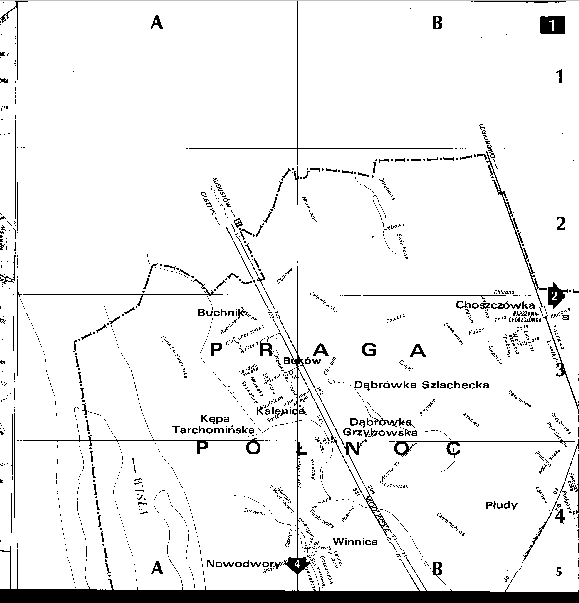
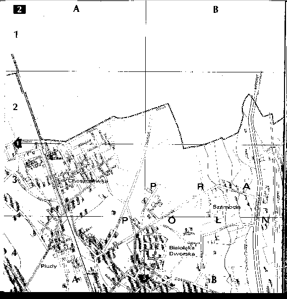
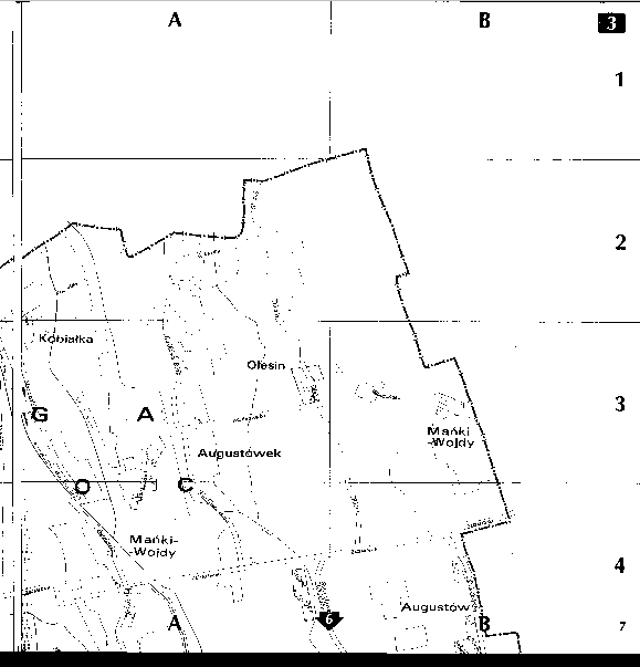
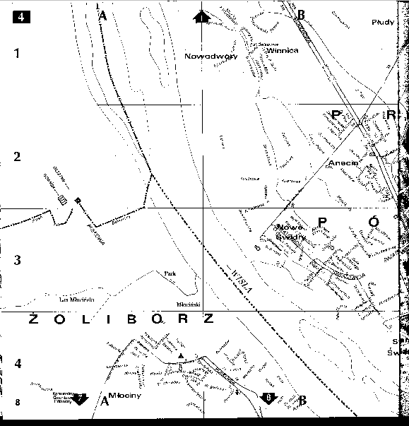
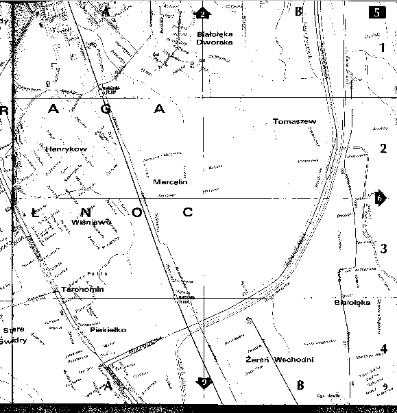
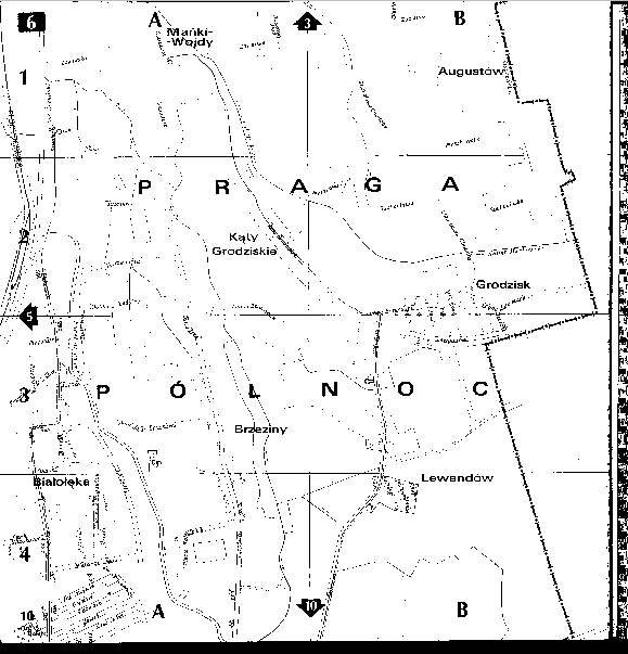
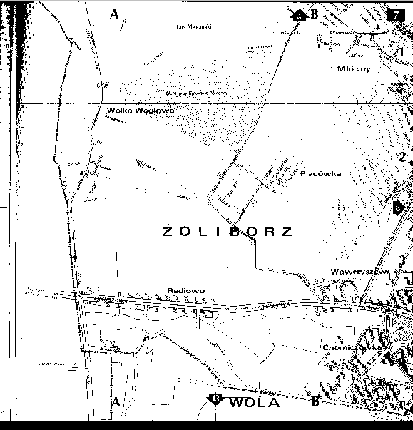
In addition, a special variable, TER_CODE, is used to identify small
geographical areas within Warsaw. TER_CODE is an alphanumeric variable
that identifies the map page and sector of the map, Warszawa Plan Miasta:
Skala ok. 1:18,000 (1992). For example, code 15A3 correspondes to map
number 15, sector A-3. Detailed geography was coded to map sectors since,
in the judgement of the Polish team, no adequate geographic information
was available from the Polish Statistical Office. Users of the small area
data are advised to consider GIS techniques to convert the map sectors
into more highly aggregated units, particularly as statistical data for
such units become available.
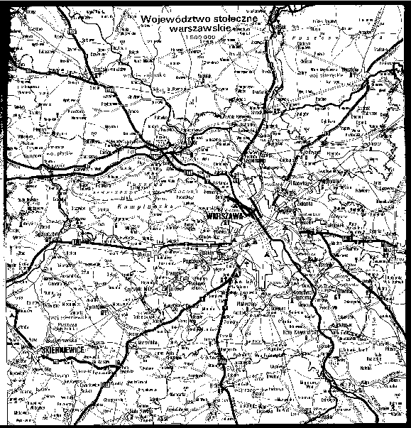
This map is shown in the following pages. The first map shows the Warsaw
region. The second map shows the City of Warsaw and the location of each
of 39 small area maps. The remaining pages are the small area maps, with
the map number shown in the upper left hand or upper right hand corner.

Back to top of this page.
For problems with this page, please e-mail libbie@ucla.edu
Return to SSEE Home.